Laterite is
a soil and rock type rich in iron and aluminium and is commonly
considered to have formed in hot and wet tropical areas. Nearly all
laterites are of rusty-red coloration, because of high iron oxide
content. They develop by intensive and prolonged weathering of the
underlying parent rock. Tropical weathering (laterization) is a
prolonged process of chemical weathering which produces a wide variety
in the thickness, grade, chemistry and ore mineralogy of the resulting
soils. The majority of the land area containing laterites is between
the tropics of Cancer and Capricorn.
Laterite has commonly been referred to as a soil type as well as being a rock type...
Historically,
laterite was cut into brick-like shapes and used in monument-building.
After 1000 CE, construction at Angkor Wat and other southeast Asian
sites changed to rectangular temple enclosures made of laterite, brick,
and stone. Since the mid-1970s, some trial sections of
bituminous-surfaced, low-volume roads have used laterite in place of
stone as a base course. Thick laterite layers are porous and slightly
permeable, so the layers can function as aquifers in rural areas.
Locally available laterites have been used in an acid solution,
followed by precipitation to remove phosphorus and heavy metals at
sewage-treatment facilities.
Laterites
are a source of aluminium ore; the ore exists largely in clay minerals
and the hydroxides, gibbsite, boehmite, and diaspore, which resembles
the composition of bauxite. In Northern Ireland they once provided a
major source of iron and aluminium ores. Laterite ores also were the
early major source of nickel.
Francis
Buchanan-Hamilton first described and named a laterite formation in
southern India in 1807. He named it laterite from the Latin word later,
which means a brick; this highly compacted and cemented soil can easily
be cut into brick-shaped blocks for building...
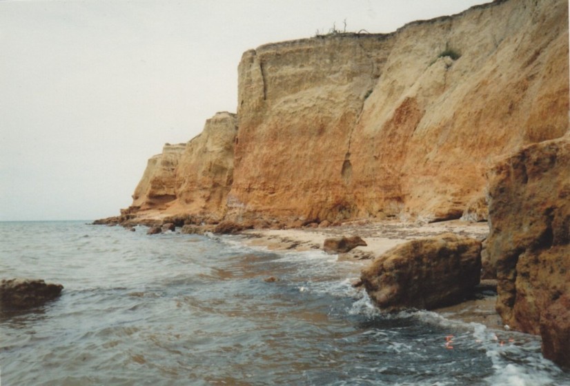
Laterite
covers are thick in the stable areas of the Western Ethiopian Shield,
on cratons of the South American Plate, and on the Australian Shield.
In Madhya Pradesh, India, the laterite which caps the plateau is 30 m
(100 ft) thick. Laterites can be either soft and easily broken into
smaller pieces, or firm and physically resistant. Basement rocks are
buried under the thick weathered layer and rarely exposed...